Kakadu 5 – Anbangbang

Anbangbang Billabong lies in the shadow of Nourlangie Rock within Kakadu National Park and is a good place to view a wide range of wildlife. Large numbers of water fowl and wading birds inhabit the billabong which can be seen from the walking trail which surrounds the billabong.

Anbangbang is close to Nourlangie, another Aboriginal site where rock art is prevelant. One of the very useful and interesting options in Kakadu is the fact that local guides give very regular and informative free talks at many sites throughout Kakadu. They are very informative and give great insight into the history and current culture s in Kakadu.

Kakadu 4 – Cahill’s Crossing

Cahill’s Crossing is a tidal river crossing point on the East Alligator River which crosses from Kakadu National Park into the restricted area of Arnhem Land. It is a fantastic place to observe the natural environment of the salt water crocodile. We saw them lining up in turns to fish where the water crosses the road – not a place to stall the engine !!

Kakadu 3 – Ubirr Rock Art

Ubirr is located in the East Alligator region of Kakadu National Park in the Northern Territory of Australia, and is famous for its rock art. It consists of a group of rock outcrops on the edge of the Nadab floodplain where there are several natural shelters that have a collection of Aboriginal rock paintings, some of which are many thousands of years old. The art depicts certain creation ancestors as well as animals from the area such as barramundi, catfish, mullet, goannas, long-necked turtles, pig-nosed turtles, rock ringtail possums, and wallabies.

From the top of Ubirr rock there is a panoramic view of the floodplains and escarpments that is especially beautiful at sunset. The rock faces at Ubirr have been continuously painted and repainted since 40,000 BC. Most paintings there were created about 2000 years ago. Some have been repainted right up to modern times. There are three main galleries of art accessible to visitors.

Kakadu 2

Aug 19 to 28 After an overnight free camp on the outskirts of Kakadu, we base ourselves at Cooinda at the Gagudju Lodge Caravan Park to explore the south and east of the park. It is now over 33 degs every day and electricity for the air conditioning is a welcome bonus.

On the way we stop to help 2 French tourists who have a major puncture. And also 2 Italian tourists with a flat battery.

Kakadu 1

Aug 19 to 28 At last we enter the Kakadu National Park, a protected area in the Northern Territory of Australia, 171 km southeast of Darwin. Kakadu National Park is located within the Alligator Rivers Region of the Northern Territory of Australia. It covers an area of 19,804 km2 (7,646 sq mi), extending nearly 200 kilometres from north to south and over 100 kilometres from east to west. It is the size of Slovenia, about one-third the size of Tasmania, or nearly half the size of Switzerland.

The name Kakadu comes from the mispronunciation of Gaagudju, which is the name of an Aboriginal language formerly spoken in the northern part of the park. Kakadu is ecologically and biologically diverse. The main natural features protected within the National Park include :
4 major river systems
the East Alligator River,
the West Alligator River,
the Wildman River; and
the entire South Alligator River;
6 major landforms
estuaries and tidal flats,
floodplains,
lowlands,
the stone country,
the outliers; and
the southern hills and basins;
A remarkable variety and concentration of wildlife;
over 280 bird species
roughly 60 mammal species
over 50 freshwater species
over 10,000 insects species
over 1,600 plant species.
Aboriginal people have occupied the Kakadu area continuously for at least 40,000 years. Kakadu National Park is renowned for the richness of its Aboriginal cultural sites. There are more than 5,000 recorded art sites illustrating Aboriginal culture over thousands of years.

Edith Falls

Aug 16 to 18 Edith Falls (local name Leliyn) is a series of waterfalls and pools in Nitmiluk National Park, the same National Park that is home to the Katherine Gorge. Edit Falls are located about 60 km north of Katherine. They are part of the Edith River. There are trails to the top of the escarpment, allowing visitors to view the waterfalls. Edith Falls is connected to Katherine Gorge via the 66 km Jatbula walk.

We stop at Katherine Gorge on the way, then free camp at the entrance to the falls for one night before camping for another 2 nights in the National Park. Edith Falls is a great and safe swimming spot, especially if you walk up the escarpment to the second level of the Falls.

Elsey National Park

Aug 14,15 Elsey is a National Park 380 kms south east of Darwin just south of Kakadu. It is the home of the spring fed Roper River. We free camp close to the river for 2 days and bush walk the 8 kms to the Mataranka Falls. There are also thermal pools which are great to relax in – the only place to swim where there are no crocodiles.

Daly Waters

Aug 13 The name Daly Waters was given to a series of natural springs by John McDouall Stuart during his third attempt to cross Australia from south to north, in 1861-2. Stuart named the springs after the new Governor of South Australia, Sir Dominick Daly.

Daly Waters Airfield was a centre for the London to Sydney air race of 1926, a refuelling stop for early Qantas flights to Singapore, a World War II Airforce base and more recently an operational base for joint military manoeuvres. Although the aerodrome was closed to commercial traffic in 1965 the original Qantas hangar still stands, housing exhibits of photographs and equipment from the area’s aviation past.

Daly Waters is also famous for its pub and we stop at the caravan site next door. In the evening we are treated to an entertaining act put on by a local known as Chilli, with stories, poems, songs and amusing anecdotes.

Banka Banka

Aug 11,12 After crossing into the Northern Territory, we free camp for one night at Frewena (the middle of nowhere) and then overnight at a small oasis of a caravan park at Banka Banka. It is an oasis because there are unlimited supplies of the freshest spring fed water you could wish to find. Time to give the car and caravan a treat with a complete wash down. The obligatory evening campfire was highlighted by another camper with his piano accordian. Great evening. (Bob cannot take credit for the camp fire).

A small mention must go to the Barkly Homestead who take a small advantage of their unique position of being the only fuel stop for miles and charging $2.06 a litre for diesel. Up until then our average cost per litre had been less than $1.50.

We take a small diversion to look at the famous Churchill Stones – supposed to look like Winston Churchill – looked more like some stones to us. Another interesting local habit – they seem to like dressing up the termite mounds in NT.

How Big Is Queensland

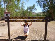
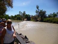
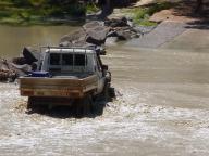
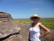
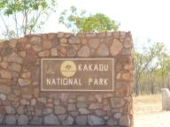
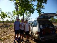
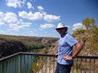
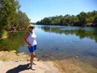
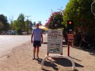
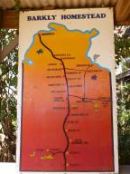
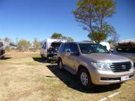
Aug 11 After 83 days and over 7,000 kilometres driven, we finally manage to escape our home state of Queensland.

Here are some interesting facts about Queensland :

• With an area of 1,727,000 square kilometres, Queensland is the second largest state in Australia. The biggest is Western Australia. Queensland is nearly 5 times the size of Japan, 7 times the size of Great Britain and 2.5 times the size of Texas.
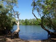
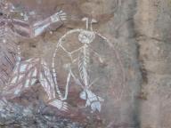
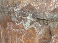
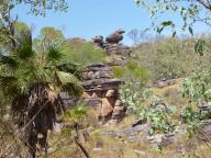
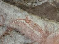
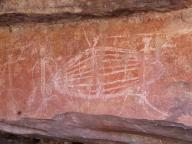
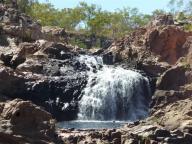
• Queensland has 5 of Australia’s 11 World Natural Heritage areas. These include the Scenic Rim National Parks, Fraser Island, Riversleigh Fossil Fields, the Wet Tropics (including Daintree National Park), and 1 of the Wonders of the World—the Great Barrier Reef.
• More than half of Queensland’s population lives outside the greater metropolitan area of Brisbane—a large proportion compared with the rest of highly urbanised Australia.
• About 1/3 of Queenslanders are migrants or the children of migrants. Most settlers in Queensland during the 19th century were from Britain and Europe. In recent years there has been an increasing number of new settlers from South-East Asia.
• Queensland is home to more than 4 million people.
• The vast majority of Queensland receives an average of between 8 and 9 hours of sunshine every day.
• The multi-award winning Tjapukai Dance Theatre in Kuranda, North Queensland, featured in the 1997 Guinness Book of Records as the entry for the longest running show in Australia. The show ran from May 1987 to July 1996, with more than 7,000 performances and 1.2 million visitors.
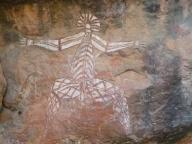
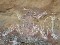
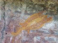
• Queensland has more than 1000 species of native vertebrates, many of them unique to the region.
• The first Labor government in the world took office in Queensland in 1899.
• The international airline Qantas (Queensland and Northern Territory Aerial Services) was established in Longreach, Queensland, in 1920.
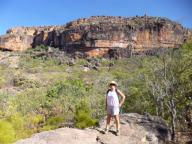
• There are over 200 national parks in Queensland, covering 6.5 million hectares.
• Four Queenslanders have been Prime Minister of Australia—Andrew Fisher (3 times: 1908–1909, 1910–1913 and 1914–1915), Arthur Fadden (1941), Francis Forde (1945) and Kevin Rudd (2007–2010).
• Free education was implemented in Queensland in 1870.
• The first Queensland railway opened in July 1865, from Ipswich to Grandchester.
• XXXX beer is one of Queensland’s well-known products and was established back in 1877.
• On 18 May 1907, women voted for the first time in a Queensland state election.
• Brisbane-born pioneer aviator Charles Kingsford Smith and his colleagues completed the first air crossing of the Pacific, from San Francisco to Brisbane, in 1928.
• Australian poet Banjo Patterson’s verse Waltzing Matilda was first sung publicly at the North Gregory Hotel in Winton, Queensland, on 6 April 1895.
• Queensland has the only State Parliament in Australia with 1 House, the Legislative Assembly. The Legislative Council (Upper House) was abolished in 1922.
• The Royal Flying Doctor Service started operating on 17 May 1928, when pilot Arthur Affleck flew the first flying doctor, Dr Kenyon St Vincent Welch, on the first official flight from Cloncurry to Julia Creek in response to an emergency call.
• The Australian Labor Party was formed in Queensland in 1891 following the bitter defeat of the shearer’s strikes of 1890–91.