Derby

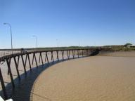
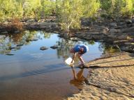
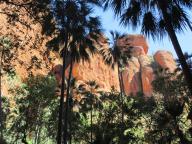
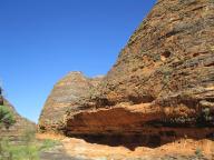
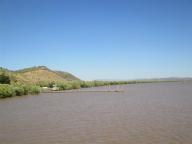
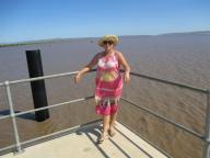
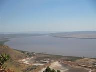
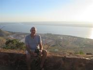
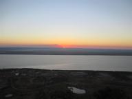
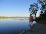
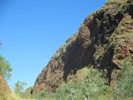
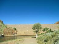
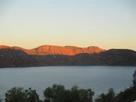
Derby is a town in the Kimberley region of Western Australia. It has a population of 3,093, with about half of Aboriginal descent. Along with Broome and Kununurra, it is one of only three towns in the Kimberley to have a population over 2,000. Located on King Sound, Derby has the highest tides in Australia, with the peak differential between low and high tide reaching 11.8 metres.

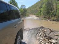
During World War II, Derby was bombed by Japanese planes because of an air base and jetty that was steadily used by Australian forces. More recently, refugees are housed at Royal Australian Air Force Base Curtin, which is located to the south of Derby.

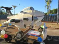
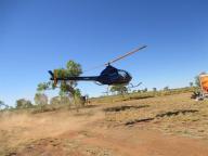
Derby was famous in the 1920s as the terminus of the first scheduled aviation service in Australia, West Australian Airways Ltd. They began their service with a first flight on 5 December 1921. At one time the Perth to Derby service was the world’s longest passenger airline route.

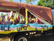
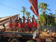
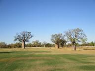
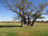
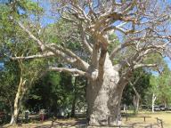
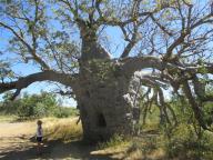
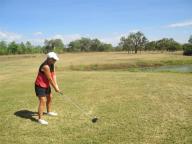
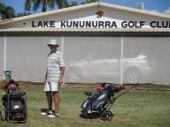
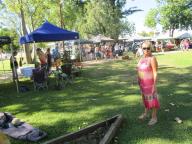
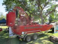
We arrive just in time for the local Boab Festival. We also play golf at Derby Golf Club, famous for the fact that there are no bunkers or hazards – just boab trees everywhere, including in the centre of the fairway ! And guess who got stuck behind the biggest ? (see photo).

A Slight Problem

We just arrived at the caravan park in Derby, stopped to top up the water tanks and when Bob opened the front boot to get the water hoses, he was greeted with a boot full of smoke. Fortunately, there was no fire. We had no electrics but, luckily, we found a local auto electrician who had us up and running the next day. An overnight stay at a hotel courtesy of RACQ was quite welcome.

Geikie Gorge

2 nights at Fitzroy Crossing gives us the chance to take a boat trip along the stunning Geikie Gorge, in its own National Park. The gorge was named in honour of Sir Archibald Geikie, the Director General of Geological Survey for Great Britain and Ireland when it was given its European name in 1883. Sir Archibald never visited the gorge and in due course the traditional owners, the Bunuba people, hope that it will be more generally known by its Aboriginal name, Darngku.

The gorge has been formed by the Fitzroy River and the level of the river in the wet season can rise by up to 16.5 metres (54 ft). The flood level can be clearly seen on the walls where the abrasive action of the floodwaters on the limestone has scoured the surface white. The limestone was originally a reef formed not by corals but by algae and lime secreting organisms that are now extinct. The river water sustains an abundance of life including barramundi, sawfish and freshwater crocodiles all of which can be found in the gorge.

Again, a quandry, too many photos – well, here goes.

Larrawa Station

We thought a night’s stay in Hall Creek may be on the cards but we decided to just drive through – not the most attractive town in the Kimberley. However, it does have 2 points of interest – 1, a bin to dispose of live cane toads ! and 2, a statue commemorating the feat of Russian Jack, Ivan Fredericks (1864–1904), a goldminer of the Western Australian gold rush in the 1880s. In 1885, while working in the Halls Creek goldmines, he pushed his sick friend in a wheelbarrow 300 Kms through the Great Sandy Desert to Wyndham, the nearest town with a medical centre. He is buried in Fremantle Cemetery.

Fortunately, after a one night free camp at Mary Pool, we discover a great farm stay at Larrawa Station. 4 Kms of dirt road take you to the farmstead of a 500,000 acre working cattle station. We shared the camp with a guy who is travelling with his own home-made helicopter. He is trying to start a business selling filmed documentaries. It was quite strange parking the caravan next to a helicopter. Fresh farm eggs at $4 per doz and beautiful fresh and clean bore water were bonuses but best of all was the camp fire and stars. Also, we were adopted by the farm dog, Morse, for the afternoon.

The Bungle Bungles

The Bungle Bungles Range is one of the highlights of the trip so far. It has presented a problem – how to refrain from adding 350 photographs to the blog !! It was a challenging drive into the Range involving over 250 Kms of rough tracks with many creek and river crossings. But it was more than worth it.

The Bungle Bungle Range is the landform that is the major component of the Purnululu National Park in Western Australia.

The distinctive beehive-shaped towers are made up of sandstones and conglomerates (rocks composed mainly of pebbles and boulders and cemented together by finer material). These sedimentary formations were deposited into the Ord Basin 375 to 350 million years ago, when active faults were altering the landscape. The combined effects of wind from the Tanami Desert and rainfall over millions of years shaped the domes. Weathering also helped create this marvel. Water seeps into the rock, and at night it expands as it gets colder. This creates small cracks which eventually wears out the rocks.

A 7 km diameter circular topographic feature is clearly visible on satellite images of the Bungle Bungle Range (Google Maps image). It is believed that this feature is the eroded remnant of a very ancient meteorite impact crater and is known as the Piccaninny impact structure.

El Questro

El Questro is a privately owned wilderness park that was previously a cattle station located in the Kimberley region of Western Australia. The park is located 110 Kms West of Kununurra and can be accessed by the Gibb River Road.

This area is not a National Park and we objected to paying an entrance fee of $40 to look at scenery that should be free, having already purchased a National Parks pass for a year ! That said, there was some excellent scenery which we ‘stole’ a look at, having left the van at a free camp near the entrance for the day. ! And it was fun driving down the Gibb River Road for a small distance. No idea how people stand 500 Kms of that torture.

Wyndham

Wyndham is the oldest and northernmost town in the Kimberley region of Western Australia, located on the Great Northern Highway, 2,210 Kms (1,373 mi) northeast of Perth. It was established in 1886 as a result of a gold rush at Halls Creek, and it is now a port and service centre for the east Kimberley with a population of 800.

The first European to visit the area was Phillip Parker King in 1819. He was instructed to find a river ‘likely to lead to an interior navigation into the great continent’. He sailed into Cambridge Gulf, which he named after the Duke of Cambridge, and then sailed up a river which was subsequently named after him (the King River).

During World War II, the town was attacked several times by Japanese aircraft.

Wyndham’s significance as a service centre was crucial for the construction of the Ord River Diversion Dam and the town of Kununurra in the early 1960s. With the rise of Kununurra as a larger population centre the significance of Wyndham as a service centre had diminished by the 1980s. Wyndham has regained significance as the port for the region with new mines shipping ore from the port.

We met the local donkey at the caravan park and explored some of the more remote gorges in the Wyndham area.

Kununurra

Kununurra is in far northern Western Australia located at the eastern extremity of the Kimberley Region approximately 37 Kms from the border with the Northern Territory. Kununurra was initiated to service the Ord River Irrigation scheme. It is 3,040 Kms (1,889 miles) from Perth via the Great Northern Highway.

The town is situated in among the scenic hills and ranges of the far north-east Kimberley Region, having an abundance of fresh water, conserved by the Ord River Diversion dam and the main Ord River Dam.

We take in some of the local scenery and also have our first experience of sand greens at the local golf club.

Lake Argyle

Just over the WA border lies Lake Argyle, Australia’s largest artificial lake by volume. It is part of the Ord River Irrigation Scheme and is located near the East Kimberley (Western Australia) town of Kununurra. The lake flooded large parts of the Shire of Wyndham-East Kimberley on the Kimberley Plateau about eighty kilometres inland from the Joseph Bonaparte Gulf, close to the border with the Northern Territory.