The Burdekin Grower Race Day at the Burdekin Race Club, Home Hill is a real eye opener. It is like the Melbourne Cup for tropical north Queensland. The fashions are amazing. And everyone gets to take home as much locally grown produce as can be carried – fabulous fresh melons, tomatoes, capsicum, corn and much much more. Eight of us went from the caravan park and a great day was had by all (especially Bob with 2 winners and 2 seconds out of 6 races).
Author: bobandsiobhand
More Fish And Crabs Plus The Boat
Typical Groper Creek Days
Catching prawns for bait off the jetty.
Exploring the many side streams and the main channels for possible fishing spots.
Species caught so far include : whiting, grunter, flathead, sickle fish, school jew, leatherjacket and lots of mudcrabs.
Allan had 13 mudcrabs in 2 crab pots today.
But the prize for the specimen catch today goes to Siobhan for a cracking flathead (see pics).
More of the same tomorrow (hopefully).
Groper Creek – Always Good To Be Back
After one last overnight free camp and a quick stop at the (world famous) Big Mango, we arrive at Groper Creek – it is like returning home to a favourite family, a real country community. We pick up the boat from a really generous country Queensland bloke – Norm – what a top man. The boat is ready for us to hook up and off we go to Groper Creek.
The first 2 days are full on fishing with some success – mud crabs, great whiting and some flathead. The prawns are ‘on’, so plenty of bait. Thanks to ‘Wasser and Pam’ who let us follow them to some productive fishing spots on the Burdekin River. We also meet one of the locals – a 4 metre croc.
Our friends from Pelican Waters, Alan and Anne Gray arrive to join us for a week. The first day on the water is very productive resulting in an entree of salt and pepper prawns and a main of fresh whiting.
After a slight mishap with the meeting of Bob’s cast net and a very large snag, Anne and Siobhan do a very good impersonation of a sewing circle to resurrect the cast net.
On The Road Again
It is Friday morning, the 2nd of May and it is time to hitch up and hit the road. The first leg up to Groper Creek is 1,200 Kms which takes 4 days , 3 nights. Our nightly stops are at free camps along the Bruce Highway. At one we are joined by some local wildlife. At another we encounter a formula 1 lawnmower event ! It is difficult to explain the wonder of the open road again.
2014 – Another (Even Bigger) Trip
The time has come for the big one ! We plan a 10 month trip which will pretty much take us around Australia. We start by heading north (away from the cold Sunshine Coast weather) to a favourite haunt, Groper Creek. Hopefully, a month’s fishing will result in a stocked freezer. An ad in the local Ayr newspaper looking for a boat to rent while we are there resulted in a call from Norm, who has offerred a tinnie for our use. Thanks Norm.
Before we start, our home needs a little care and attention.
Then we pick up the van from storage and park at our unit for 3 days to get everything loaded.
Trip Ended Prematurely
Most friends following our caravan travels will be aware that we cut our trip last year short due to the sad illness of a close friend. The New Trip will begin in early May 2014.
Coober Pedy
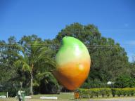
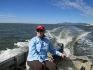
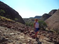
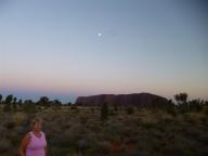
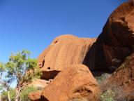
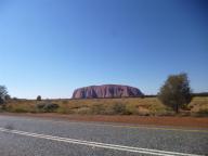
Sep 27 to 29 We cross the Northern Territory border into South Australia with our first stop in Coober Pedy. Where to start when describing Coober Pedy ? Lets try some adjectives first – quirky, strange, weird, dry (they have 2 seasons here – dry, dry and hot), fun, unique and, of course, underground.
Coober Pedy is a town in northern South Australia, 846 kilometres north of Adelaide on the Stuart Highway. Its population is 1,695 (953 males, 742 females, including 275 indigenous Australians). The town is sometimes referred to as the “opal capital of the world” because of the quantity of precious opals that are mined there. Coober Pedy is renowned for its below-ground residences, called “dugouts”, which are built due to the scorching daytime heat. The name “Coober Pedy” comes from the local Aboriginal term kupa-piti, which means “white man’s hole”.
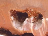
Opal was found in Coober Pedy on 1 February 1915; since then the town has been supplying most of the world’s gem-quality opal. Coober Pedy today relies as much on tourism as the opal mining industry to provide the community with employment and sustainability. Coober Pedy has over 70 opal fields and is the largest opal mining area in the world.
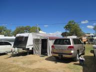
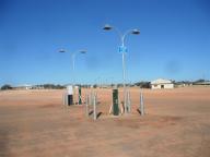
Water is so scarce here that they have water bowsers that look like fuel pumps (see picture). it costs 40 cents for 40 litres.
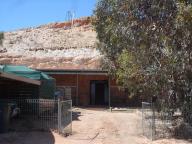
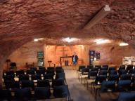
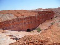
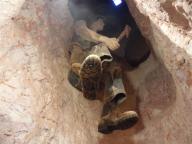
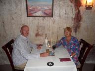
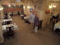
There are over 1,000,000 holes dug into the ground. There are many underground houses, churches, shops, hotels, bars, etc. People live underground because of the consistent temperature there – 22 to 25 degs, all year round, when the outside temperature can reach the low 50’s C. We even had dinner in an underground restaurant.
The Olgas
Sep 26 The Olgas (also known as Kata Tjuta) are a group of large domed rock formations or bornhardts located just 15 or so kms from Uluru.
The 36 domes that make up Kata Tjuta cover an area of 21.68 km2 (8.37 sq mi), are composed of conglomerate, a sedimentary rock consisting of cobbles and boulders of varying rock types including granite and basalt, cemented by a matrix of sandstone.
The highest point, Mount Olga, is 1,066 m (3,497 ft) above sea level, or approximately 546 m (1,791 ft) above the surrounding plain (198 m (650 ft) higher than Uluru).
Not quite as spiritual as Uluru but still impressive.
Uluru – Ayres Rock
Sep 22 to 26 The definite highlight of the trip so far.
Uluru (also known as Ayers Rock) is a large sandstone rock formation in the southern part of the Northern Territory in central Australia. It lies 335 km (208 mi) south west of the nearest large town, Alice Springs, 450 km (280 mi) by road.
Uluru is sacred to the Anangu, the Aboriginal people of the area. The area around the formation is home to a plethora of springs, waterholes, rock caves, and ancient paintings. Uluru is listed as a UNESCO World Heritage Site.
Uluru is one of Australia’s most recognisable natural landmarks. The sandstone formation stands 348 m (1,142 ft) high, rising 863 m (2,831 ft) above sea level, with most of its bulk lying underground, and has a total circumference of 9.4 km (5.8 mi). Uluru is notable for appearing to change colour at different times of the day and year, most notably glowing red at dawn and sunset.
So much for the technical stuff, now here is a list of personal descriptive adjectives that describe the experience of visiting this magical place – inspirational, awesome, moving, spiritual, exciting, historic, powerful, magical, peaceful – you get the idea.
We did not climb the rock as the local aboriginals regard it as sacred and we wanted to respect their culture. We did do the ‘base walk’ which is a 10.6 kms walk in a complete circle around the rock. We also took a million photos so here are just a few of them.


