Point Quobba

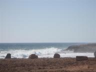
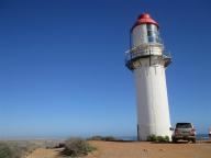
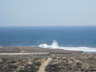
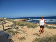
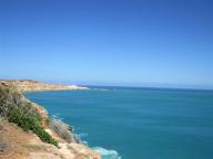
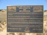
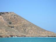
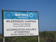
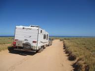
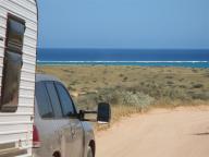
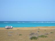
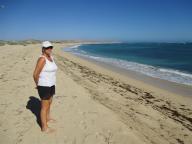
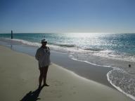
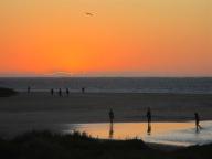
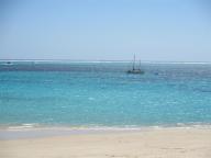
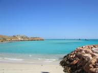
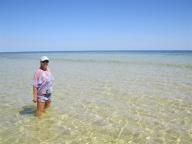
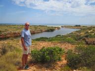
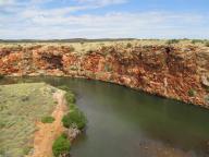
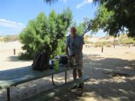
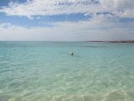
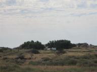
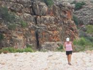
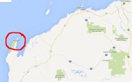
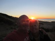
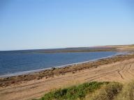
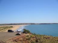
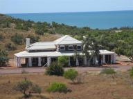
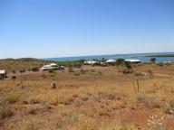
Point Quobba is 75 Kms north of Carnarvon on the west coast of WA. It is well known for the impressive blow holes which seem to be active all the time as the wind and waves are constantly battering the coast. No longer is the Ningaloo Reef in the way to temper the effect of the waves. Red Bluff is another sight to see after a bone-shaking unsealed drive of approx 65 Kms. This is the area where the wreck of the HMAS Sydney was found. The ship was sunk by a German raider in 1941 with the total loss of its complete crew of 645.

Waroora Station

Waroora Station (pronounced Warra) is a family run sheep and cattle station which offers wilderness camping sites literally on the beach. Its position means exposure to quite a lot of wind so the fishing was a little difficult (Bob’s excuse anyway). Yet another beautiful campsite.

Coral Bay

Coral Bay is positioned towards the southern end of Ningaloo Reef. It is famous for its pristine beaches, sparkling blue waters and fish feeding at the beach. The main industries are tourism and fishing. The electricity for the town is provided by a wind-diesel hybrid system. Coral Bay was formally settled in 1968 and was named after a hotel that had been established in the area.

Cape Range National Park

What an awesome place. Cape Range National Park occupies the western side of the North West Cape peninsula over an area of 47,655 hectares (117,760 acres). The nearest town is Exmouth. Directly off the coast is the Ningaloo Reef. You can literally walk out to the reef from the beach. Snorkelling is fantastic and the abundance of wildlife includes whales, dolphins and turtles. The water is crystal clear and warm – even Bob was spotted submerged ! Yardie Creek, a spectacular gorge where the water is trapped by a sandbar, is located within the park – we did the walk in the gorge and managed to sight some rock wallabies – very rare. Bush camps are dotted along the coast within the park. Ours is called Ned’s Camp, a small and very friendly camp with only 9 sites and right on the beach. Lots of pictures here.

Exmouth

Exmouth is a town on the tip of the North West Cape in Western Australia. The town was established in 1967 to support the nearby United States Naval Communication Station Harold E. Holt. Beginning in the late 1970s, the town began hosting U.S. Air Force personnel assigned to Learmonth Solar Observatory, a defence science facility jointly operated with Australia’s Ionospheric Prediction Service. Nowadays the town relies more on tourism than the station for its existence. On 22 March 1999, Tropical Cyclone Vance reached category 5 status as it made landfall near Exmouth. This resulted in the highest ever wind gust reported on the Australian mainland of 267 km/h at Learmonth, only 35 km to the south.

We spend the night in town before we head off to the nearby Cape Range National Park – see later blog. The local wildlife was interesting with a friendly emu in the caravan park. See if you can spot the large stingray in the picture.

40 Mile Beach

40 Mile Beach is found at the unfortunately named Gnoorea Point about 65 Kms west of Karratha. Fresh water is available on the entry road at the gas plant for a gold coin donation to the RFDS. Bush camped for 4 nights at the edge of the beach. Fishing not so good but did manage to snag a Spotty Mackerel.

Point Samson

Our last trip from our Cleaverville base is to Point Samson, a small coastal settlement and a popular holiday location for the nearby mining towns, including Wickham, Karratha and Dampier. Fishing is the main industry. From 1938 to 1966 blue asbestos or crocidolite was carried here by rail from Wittenoom for shiploading by Australian Blue Asbestos Pty Ltd. The population of Point Samson was 274 in 2006. Great fish and chips at the tavern for lunch !

Cossack

Cossack is a well peserved historic ghost town located 15 km from Roebourne in the Pilbara region of Western Australia. The nearest town to Cossack is Wickham. Cossack is located on Butchers Inlet at the mouth of the Harding River. It is reached by a single, sealed road that follows the original causeway across a series of tidal salt flats. The site of the former town is defined by Nanny Goat Hill, Tien Tsin Lookout, the hilly ground to the north-east and north-west, and Butchers Inlet to the east and south-east. Past the townsite, the road winds up to the Reader Head Lookout, from which sweeping views of the surrounding coastline can be seen. Many of the buildings are listed by the National Trust.